- Home
- About Us
- Product
- Services
- Gallery
- Contact Us
Call Us
Marine, Navigational & Floating Systems
Container Lashing
Cargo Strapping Products
Cargo Lashing Products
Container Parts & Accessories
Lifting Sling & Accessories
Timber/Wood Packaging Products
Corrugated/Honeycomb Products
Shrink/Multi-Wrap & Accessories
VCI & Anti-Corrosive Products
Cold Chain/Thermal Packaging Products
General Packaging Products
Container seals & Cable seals
Safety Cutters
Stenciling, Coding & Marking Products
Strapping, Shrining & Fastening Tools & Accessories
Boat/Yatch Skids
Shock Impact & Temperature Monitoring Products
Airwave Accessories & Spare parts
Strapping, Lashing Tensioners & Dispensers
Cargo Protection & Lifting nets
Fasteners & Wood working tools
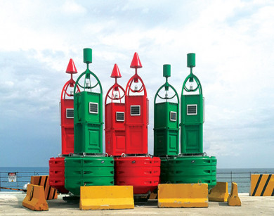
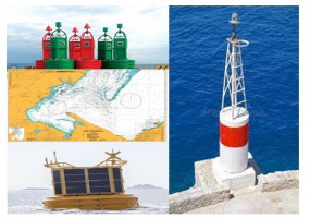
Navigation buoys alert ships to high-risk areas and can distinguish lines of safe passage in bodies of water. These floating markers are used for many different purposes — for example, marking channel entrances and underwater and surface hazards such as disused platforms.
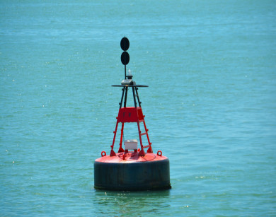
A mooring buoy is a floating structure used as a navigational aid, position locator, or mooring point for ships. Marker buoy marks a position of an underwater object, which facilitates mooring ships and various other purposes.
Jetty Mast systems are used to support navigation lights for maring the extremities of a jetty - as well as entrances to harbours, marinas and other navigation channels. All jetty masts and lights conform to IMO regulations and IALA recommendations.
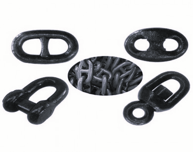
The Grade 80 chains are supplied in a number of different material grades, with grade 2 and 3 being the most common for ships’ equipment and buoy moorings, while other grades such as ORQ and R4 have applications within the offshore industry.
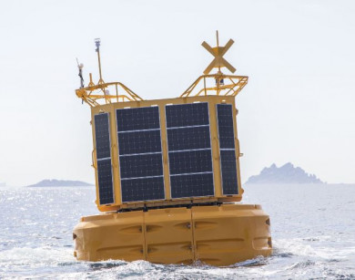
SAS offers a complete range of acquisition data buoys (or smart buoy), perfect support to accommodate all the necessary instrumentation for measurements at sea : sensors, modems, data transmission, technical compartments, wind or solar generators. The larger models are safely accessible and can...
A nautical chart is one of the most fundamental tools available to the mariner. It is a map that depicts the configuration of the shoreline and seafloor. It provides water depths, locations of dangers to navigation, locations and characteristics of aids to navigation, anchorages, and other feat...